maps, brochures, programs, and other memorabilia (ft. extensive photos of my carpet)
For uninteresting reasons, I've recently had to move all of my stuff from one room in my house to another. There are two factors which combine to make this process interesting: one, I've lived in the first room for over 10 years at this point, and, two, I've always had a penchant for collecting and keeping memorabilia. This means that while cleaning, I've found all sorts of old stuff—a journal I kept in 2008 (i.e. when I was six years old), a small collection of rocks from the hills in the area, the sheet music for a small song I wrote in elementary school. Three particularly prominent categories of items are maps, brochures, and programs, and so over the past few days I've been scouring them and taking an inventory. From the pile I went through, I found 31 brochures (a broadly defined term referring to descriptions of locations, including maps of attractions), 21 maps, and 7 programs. These span a range of around 13 years, from 2006 to 2019; the earliest strongly confident dates are in 2009, where there exist three corroborating documents from Washington D.C. The full inventory can be found here, and a map of all the relevant locations can be found here.
Here are some of the more interesting collections of items:
Earliest Items
The items which appear to be from 2006 are two brochures for National Parks Service (NPS) sites, the Badlands and Mount Rushmore:
 |
| guess where I live? |
The reason I have the caveat "appear to be" is that there's no clear date on NPS brochures, only a very tiny copyright date which gives a bound for the earliest the brochure can be from, as shown below:
The copyright date for the Mount Rushmore brochure is 2005, but since I moved to South Dakota in 2006, the brochures have to come from after that point. Given that it's likely that these brochures come from one of my first trips to these places (which I have visited many times since), it can't be too much later than 2006. This speculation is also likely pointless, since I was four in 2006 and therefore probably don't have anything else from the era to validate against.
Other NPS Brochures
I also have a collection of other NPS brochures, all of which, I must say, are very pretty.
I'm not sure why Muir Woods and Wind Cave have the logo on the top-right when none of the others do, but it doesn't seem to be publication date related. I also have some Junior Ranger [a program at National Parks for children; if you complete a certain number of activities, you get a plastic park ranger badge as shown in the Grand Canyon booklet] activity booklets.
Cartoon Maps
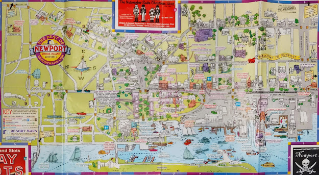
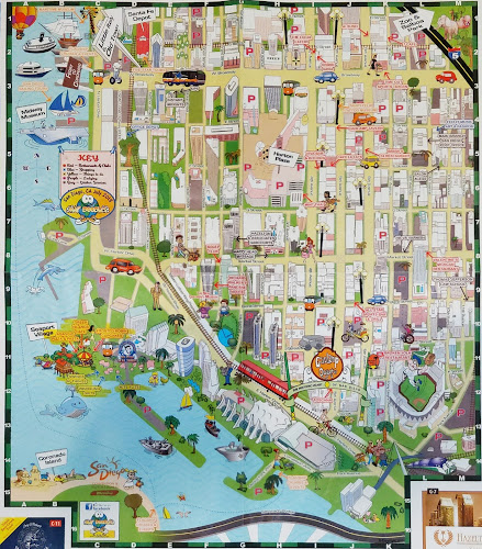
There's a sort of category of maps, seemingly all done by different publishers, which are sort of cartoon-esque, with little illustrations of all of the buildings and colorful arrows and text pointing to each of them. They're usually found in smaller towns, and tend to be free at hotels, with a ton of ads surrounding them for local tourist attractions and whatnot. Here are four of them: [the photos aren't the best quality because they're stitched together from four images by PhotoScan, since the maps are so big]
Newport, Rhode Island:
 |
| tag yourself, I'm "fudgery" |
San Diego, California:
 |
| tag yourself, I'm the whale in the lower-left |
a brief ticket interlude
Among my memorabilia collection, I also keep a lot of tickets of various things, from transportation to concerts. Here are a few I found in an envelope in this pile:
 |
| one of these things is not like the others |
I've always been pretty fascinated with transportation systems, and so I keep a lot of tickets from trips. In particular, the three blue tickets are from the Chinese high-speed rail system, which is fascinating to me because it is generally well-developed, high-throughput, and runs almost entirely on time (within like a 5-minute margin, and that feels like a high estimate).
Programs
Here are four of the seven programs in the inventory. The first two are from an annual lecture series in the town I'm from. We've gotten some very interesting speakers in the past, as shown below:
I think this was one of the first public talks given by Cameron after stepping down from Prime Ministership. There's a Guardian article about it that is almost desperately searching for material about Rapid City including quotes like "in the shadow of Mount Rushmore" (30 mins. away) and "a stone’s throw from the old west frontier town of Deadwood" (45 mins. away).
Below are two Playbills, one real, one fake and made at 7 AM on a Friday. (Guess which is which.)
Miscellaneous
Here are some more random assortment of items. This, for example, is an item I found particularly interesting—it starts as small box type item, which looks like it would contain postcards of the locations pictured on the front. [The specific location is the gardens of Suzhou, China.]
However, it turns out this is actually a map in disguise!
 |
| apologies for the glare on this one |
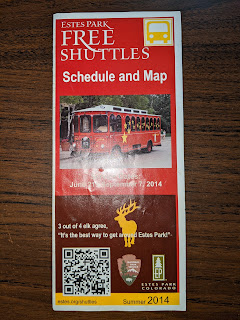
Here's another map-based one. This looks like an innocuous map of shuttles in Estes Park, Colorado, right? Well, around 3/4ths of the way down the brochure, we get a very interesting review of the service.
 |
| someone had fun designing this one |
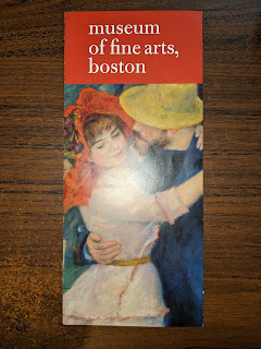
Another item I found particularly heartwarming is the following brochure of the Museum of Fine Arts in Boston:
This would not be particularly interesting, if not for the fact I had visited the Museum of Fine Arts (MFA) again last November/December, which is free for MIT students. The whole trip was quite fun; my friend and I took the 1 bus down to the Symphony area and then walked to the MFA. Walking around all of the exhibits was a great experience, but what I remember the most is walking out and seeing a fresh layer of snow, the first significant snow of the season, and I was so deeply happy. I'd missed it a lot, coming from a place where the first snow is usually in mid-October. The city was coated in a fine layer of snow, and on the way back everything looked new, ready to be explored once more. Seeing the brochure again brought back all of these memories, although I don't remember exactly the first time I had visited.
Finally, the following image is a map of the Boston area provided by a car rental company.
Why is this image interesting at all? Well, it contains the following map of campus:
What are the two rectangular boxes far in West Campus? Why is Maseeh so small? What did they do to Stata? Why is only the East Parallel of East Campus present? Who made this map? Why did they make it like this? This raises so many questions, and none of them are answered.


Comments
Post a Comment
Comments are appreciated, as long as you're not being a total jerk.